
-
 : Welcome to Beaumaris Weather |
 -
 : ENSO Outlook ( Current Status ) Inactive by Bureau of Meteorology |
 -

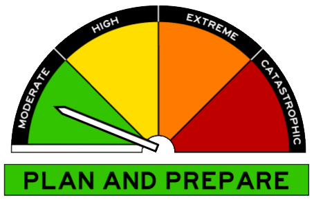
 : Fuel Reduction Smoke Alert - New Ecclestone Road, Riverside - Avoid smoke by TasALERT |
 - : Bushfire Smoke Alert - Bass Highway, Port Latta, Crayfish Creek and surrounds - Avoid smoke by TasALERT |
-
 27/05:00 EST Marine Wind Warning Summary for Tasmania |
 - 27/01:52 EST Frost Warningfor Midlands forecast district |
-
 : North East Fresh Water - Tasmania : Call Liam or Jon on 0422 195 649 |
 -
 : Bonsoy Gold Coast Pro surf forecast |
 - : Uncontrolled WA fire causes massive smoke plume |
- : Storms hitting WA as Perth's wait for rain continues |
-
 : New weather radar brings increased coverage to Toowoomba and surrounds |
 - : April 16 2024 Climate Driver Update: Tropical Pacific Ocean now ENSO neutral |
- : Bureau of Meteorology's 2024 Autumn Long-Range Forecast |
| |
| Onsite Data Updated: @ 27/04/2024 09:15 - next update at 09:20 | ||||||||||||||||||||||||||||||||||||||||
| Sky / Temperature / Summary | Wind | Rain | Air Quality | |||||||||||||||||||||||||||||||||||||
|
|
|
|
|||||||||||||||||||||||||||||||||||||
| Humidity & Barometer | Almanac | Moon | ||||||||||||||||||||||||||||||||||||||
|
|
|
||||||||||||||||||||||||||||||||||||||
| UV Index | Solar Radiation | |||||||||||||||||||||||||||||||||||||||
|
|
|||||||||||||||||||||||||||||||||||||||


| Australian Extremes | High Temp : 37.2° C | Low Temp : -3° C | Precipitation : 19.4 mm |
| Past 24 hours | Yampi Sound | Liawenee | Milingimbi Aws |
| Beaumaris Onsite Forecast ( Updated every 3 Hours ) : Last Updated : Saturday, 27-Apr-2024 08:00 AEST | |||
 Beaumaris Onsite Forecast Detail
| Note : Our Onsite Day forecasts cover the times of 06:00 - 18:00 and Night forecasts cover 18:00 - 06:00 | ||||||||||
|
Next 6hr ( 18z ) Beaumaris Onsite WxSim Forecast due on ( Sat 27 at 11:25 AEST ) WxSim-EUROMIX ( 100 % GFS Run ( 2024-04-26-12 Z ) and 0 % ECMWF Mix Run ( 12 Z )) | ||||||||||
Today : Sunny. Patchy light fog in the morning. Mild. High 20°. UV index up to 3. Wind west near calm in the morning, becoming north-northeast around 8 kph, gusting to 24 kph, in the afternoon. |
||||||||||
Tonight : Mostly cloudy in the evening, becoming partly to mostly cloudy after midnight. Low 9°. Wind west-northwest around 10 kph. |
||||||||||
Sunday : Partly cloudy. Mild. High 20°. UV index up to 3. Wind west-northwest around 14 kph, gusting to 32 kph, in the morning, becoming 21 kph, gusting to 35 kph, in the afternoon. |
||||||||||
Sunday night : Fair to partly cloudy in the evening, becoming mostly cloudy after midnight. A slight chance of rain after midnight. Breezy. Low 11°. Wind north-northwest around 22 kph, gusting to 35 kph. Chance of precipitation less than 20 percent. Precipitation mostly less than 2 mm. |
||||||||||
Monday : Mostly cloudy in the morning, becoming partly to mostly sunny in the afternoon. A chance of rain. Breezy. High 18°. UV index up to 2. Wind northwest around 18 kph, gusting to 37 kph, in the morning, becoming southwest in the afternoon. Chance of precipitation 30 percent. Precipitation mostly less than 2 mm. |
||||||||||
Monday night : Clear. Patchy light fog after midnight. Breezy and cool. Low 4°. Wind southwest around 23 kph, gusting to 38 kph, in the evening, becoming 14 kph, gusting to 29 kph, after midnight. |
||||||||||
Tuesday : Sunny in the morning, becoming partly to mostly cloudy in the afternoon. Light to moderate fog in the morning. High 18°. UV index up to 2. Wind southwest around 11 kph, gusting to 26 kph. |
||||||||||
Tuesday night : Mostly cloudy in the evening, becoming partly cloudy after midnight. A slight chance of rain. Low 7°. Wind south-southwest around 13 kph, gusting to 25 kph. Chance of precipitation less than 20 percent. Precipitation mostly less than 2 mm. |
||||||||||
Wednesday : Sunny. High 17°. UV index up to 2. Wind south-southwest around 16 kph, gusting to 32 kph. |
||||||||||
Wednesday night : Fair to partly cloudy in the evening, becoming partly cloudy after midnight. A slight chance of rain after midnight. Cool. Low 6°. Wind south around 15 kph, gusting to 30 kph. Chance of precipitation less than 20 percent. Precipitation mostly less than 2 mm. |
||||||||||
Thursday : Partly to mostly sunny. A slight chance of rain in the afternoon. High 17°. UV index up to 2. Wind south-southwest around 14 kph, gusting to 28 kph. Chance of precipitation less than 20 percent. Precipitation mostly less than 2 mm. |
||||||||||
Thursday night : Partly cloudy in the evening, becoming fair to partly cloudy after midnight. A slight chance of rain. Cool. Low 6°. Wind south-southeast around 13 kph, gusting to 26 kph, in the evening, becoming south-southwest after midnight. Chance of precipitation less than 20 percent. Precipitation mostly less than 2 mm. |
||||||||||
Friday : Partly to mostly sunny in the morning, becoming partly cloudy in the afternoon. Patchy light fog in the morning. A slight chance of rain. High 16°. UV index up to 2. Wind south-southwest around 10 kph in the morning, becoming south-southeast in the afternoon. Chance of precipitation less than 20 percent. Precipitation mostly less than 2 mm. |
||||||||||
Friday night : Partly cloudy in the evening, becoming fair to partly cloudy after midnight. Patchy light fog after midnight. A slight chance of rain. Cool. Low 5°. Wind south around 11 kph. Chance of precipitation less than 20 percent. Precipitation mostly less than 2 mm. |
||||||||||
Saturday : Sunny. Patchy light fog in the morning. High 16°. UV index up to 2. Wind south-southwest around 4 kph in the morning, becoming northeast in the afternoon. |
||||||||||
|
|
||||||||||
|
||||||||||

| East Coast / Beaumaris - Forecast by Bureau of Meteorology | |||||
| Day / Summary | Beaumaris / East Coast Forecast / Detail | ||||
Forecast for the rest of Saturday 8 °C 19 °C Possible rainfall : 0 mm Chance of any rain : | Partly cloudy. Patches of morning frost about higher ground. Light winds. Daytime maximum temperatures between 15 and 18. | ||||
| Sunday 28 April 9 °C 18 °C Possible rainfall : 0 mm Chance of any rain : | Cloudy. Winds northwesterly 25 to 35 km/h. Overnight temperatures falling to between 4 and 9 with daytime temperatures reaching between 14 and 19. | ||||
Monday 29 April 12 °C 17 °C Possible rainfall : 0 mm Chance of any rain : | Partly cloudy. Slight chance of a shower, most likely in the morning. Winds northwesterly 25 to 35 km/h turning westerly 25 to 40 km/h during the morning then decreasing to 15 to 25 km/h during the evening. Overnight temperatures falling to between 7 and 12 with daytime temperatures reaching between 12 and 17. | ||||
| Tuesday 30 April 6 °C 15 °C Possible rainfall : 0 mm Chance of any rain : | Cloudy. Patches of morning frost about higher ground. Slight chance of a shower in the south, near zero chance elsewhere. Winds westerly 20 to 30 km/h turning southwesterly during the morning. Overnight temperatures falling to between 1 and 6 with daytime temperatures reaching between 10 and 14. | ||||
| Wednesday 1 May 7 °C 15 °C Possible rainfall : 0 mm Chance of any rain : | |||||
| Thursday 2 May 7 °C 15 °C Possible rainfall : 0 mm Chance of any rain : | |||||
| Friday 3 May 7 °C 15 °C Possible rainfall : 0 mm Chance of any rain : | |||||
| Forecast issued at 7:00 am AEST on Saturday 27 April 2024. The next routine forecast will be issued at 4:25 pm AEST Saturday. | |||||
| Upper East Coastal Waters Forecast : St Helens Point to Wineglass Bay by : Bureau of Meteorology | |||
| Weather Situation : | |||
|
View Full Screen |
View Full Screen |
||
|
View Full Screen : Warnings | Wind Gust | Pressure | Temperature | Dew Point | Cloud Cover | Ocean Waves | Ocean Swell | Sea Temperature |
| Countdown to Winter : Winter Solstice begins 21 June at 6:51am AEST | |||
|
Today's Fishing Action Rating ( 2 ) |
|||
|
|
|||
| Beaumaris Onsite ( Last 12 Hours ) Data |