
-
 : Welcome to Beaumaris Weather |
 -
 : ENSO Outlook ( Current Status ) Inactive by Bureau of Meteorology |
 -

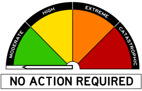
 : Flood Advice - St Pauls River - Monitor conditions by TasALERT |
 - : Smoke Alert - Bushfire - Plenty Valley Road, Glenfern - Avoid smoke by TasALERT |
- : Bushfire Smoke Alert - Bass Highway, Port Latta, Crayfish Creek and surrounds - Avoid smoke by TasALERT |
-
 11/11:48 EST Marine Wind Warning Summary for Tasmania |
 - 11/11:00 EST Flood Warning Summary (TAS) |
- 11/11:00 EST Minor Flood Warning for the St Pauls River |
-
 : North East Fresh Water - Tasmania : Call Liam or Jon on 0422 195 649 |
 -
 : Wettest start to May in two decades for Sydney |
 - : Tornado tears through Bunbury as severe thunderstorms continue in southwest WA |
- : Watch Kati Thanda-Lake Eyre filling over past five weeks |
-
 : The Bureau issues a warning for a G4 geomagnetic storm |
 - : Heavy rain on the way for much of New South Wales |
- : New weather radar brings increased coverage to Toowoomba and surrounds |
| |
| Onsite Data Updated: @ 11/05/2024 12:25 - next update at 12:30 | ||||||||||||||||||||||||||||||||||||||||
| Sky / Temperature / Summary | Wind | Rain | Air Quality | |||||||||||||||||||||||||||||||||||||
|
|
|
|
|||||||||||||||||||||||||||||||||||||
| Humidity & Barometer | Almanac | Moon | ||||||||||||||||||||||||||||||||||||||
|
|
|
||||||||||||||||||||||||||||||||||||||
| UV Index | Solar Radiation | |||||||||||||||||||||||||||||||||||||||
|
|
|||||||||||||||||||||||||||||||||||||||


| Australian Extremes | High Temp : 38.9° C | Low Temp : 1.2° C | Precipitation : 79 mm |
| Past 24 hours | Yampi Sound | Liawenee | Merimbula Airport |
| Beaumaris Onsite Forecast ( Updated every 3 Hours ) : Last Updated : Saturday, 11-May-2024 11:00 AEST | |||
 Beaumaris Onsite Forecast Detail
| Note : Our Onsite Day forecasts cover the times of 06:00 - 18:00 and Night forecasts cover 18:00 - 06:00 | ||||||||||
|
Next 3hr ( 18z ) Beaumaris Onsite WxSim Re-Forecast due on ( Sat 11 at 14:25 AEST ) WxSim-EUROMIX ( 100 % GFS Run ( 2024-05-10-18 Z ) and 0 % ECMWF Mix Run ( 12 Z )) | ||||||||||
This afternoon : Cloudy. Patchy light fog. A slight chance of rain. High 15°. UV index up to 1. Wind southeast around 9 kph. Chance of precipitation less than 20 percent. Precipitation mostly less than 2 mm. |
||||||||||
Tonight : Cloudy in the evening, becoming mostly cloudy to cloudy after midnight. Patchy light fog after midnight. A chance of rain. Low 10°. Wind southeast around 4 kph. Chance of precipitation 30 percent. Precipitation mostly less than 2 mm. |
||||||||||
Sunday : Partly cloudy in the morning, becoming partly to mostly cloudy in the afternoon. Patchy light fog in the morning. A slight chance of rain. High 16°. UV index up to 1. Wind south-southeast around 4 kph in the morning, becoming northeast in the afternoon. Chance of precipitation 20 percent. Precipitation mostly less than 2 mm. |
||||||||||
Sunday night : Mostly cloudy in the evening, becoming cloudy after midnight. Patchy light fog. A chance of rain. Low 11°. Wind northeast around 9 kph in the evening, becoming northwest after midnight. Chance of precipitation 30 percent. Precipitation mostly less than 2 mm. |
||||||||||
Monday : Mostly cloudy to cloudy in the morning, becoming mostly cloudy in the afternoon. Patchy light fog in the morning. A slight chance of rain. Mild. High 19°. UV index up to 2. Wind northwest around 17 kph, gusting to 33 kph. Chance of precipitation less than 20 percent. Precipitation mostly less than 2 mm. |
||||||||||
Monday night : Mostly cloudy to cloudy in the evening, becoming partly cloudy after midnight. A slight chance of rain. Low 8°. Wind northwest around 9 kph, gusting to 27 kph, in the evening, becoming west after midnight. Chance of precipitation less than 20 percent. Precipitation mostly less than 2 mm. |
||||||||||
Tuesday : Partly to mostly sunny in the morning, becoming mostly sunny in the afternoon. Patchy light fog in the morning. High 17°. UV index up to 1. Wind west around 10 kph, gusting to 25 kph. |
||||||||||
Tuesday night : Clear. Patchy light fog in the evening, then light to moderate fog after midnight. Low 8°. Wind west around 12 kph. |
||||||||||
Wednesday : Partly cloudy in the morning, becoming mostly cloudy in the afternoon. Mild. High 19°. UV index up to 1. Wind west-northwest around 16 kph, gusting to 30 kph. |
||||||||||
Wednesday night : Partly cloudy. Patchy light fog after midnight. Low 9°. Wind west-northwest around 13 kph, gusting to 28 kph. |
||||||||||
Thursday : Sunny. Patchy light fog in the morning. Mild. High 20°. UV index up to 2. Wind northwest around 12 kph, gusting to 28 kph, in the morning, becoming 20 kph, gusting to 35 kph, in the afternoon. |
||||||||||
Thursday night : Partly cloudy in the evening, becoming partly to mostly cloudy after midnight. Low 11°. Wind northwest around 15 kph, gusting to 30 kph. |
||||||||||
Friday : Mostly cloudy in the morning, becoming cloudy in the afternoon. A chance of rain in the afternoon. High 17°. UV index up to 1. Wind west-northwest around 8 kph in the morning, becoming south around 15 kph, gusting to 33 kph, in the afternoon. Chance of precipitation 40 percent. Precipitation mostly less than 2 mm. |
||||||||||
Friday night : Dense overcast. A chance of rain in the evening, then a slight chance of rain after midnight. Low 9°. Wind south around 17 kph, gusting to 33 kph, in the evening, becoming 12 kph, gusting to 25 kph, after midnight. Chance of precipitation 60 percent. Precipitation mostly around 5 mm. |
||||||||||
Saturday : Dense overcast. Patchy light fog. A chance of rain. High 10°. UV index up to 0. Wind south around 6 kph. Chance of precipitation 40 percent. Precipitation mostly less than 2 mm. |
||||||||||
|
|
||||||||||
|
||||||||||

| East Coast / Beaumaris - Forecast by Bureau of Meteorology | |||||
| Day / Summary | Beaumaris / East Coast Forecast / Detail | ||||
Forecast for the rest of Saturday 10 °C 15 °C Possible rainfall : 1 to 5 mm Chance of any rain : | Partly cloudy. The chance of morning fog in the south. Medium chance of showers, becoming less likely late this afternoon and evening. Light winds. Daytime maximum temperatures between 11 and 15. | ||||
| Sunday 12 May 10 °C 16 °C Possible rainfall : 0 to 3 mm Chance of any rain : | Partly cloudy. Medium chance of showers in the north, slight chance elsewhere. Light winds becoming north to northeasterly 15 to 20 km/h in the late afternoon then becoming light in the late evening. Overnight temperatures falling to between 4 and 9 with daytime temperatures reaching between 13 and 17. | ||||
| Monday 13 May 10 °C 17 °C Possible rainfall : 0 to 2 mm Chance of any rain : | Cloudy. The chance of morning fog about higher ground. Medium chance of showers, most likely in the morning and afternoon. Winds northerly 15 to 20 km/h turning westerly during the afternoon. Overnight temperatures falling to between 5 and 10 with daytime temperatures reaching between 12 and 18. | ||||
Tuesday 14 May 7 °C 17 °C Possible rainfall : 0 mm Chance of any rain : | Partly cloudy. Winds westerly 15 to 20 km/h turning northwesterly during the afternoon. Overnight temperatures falling to between 3 and 9 with daytime temperatures reaching between 12 and 17. | ||||
| Wednesday 15 May 8 °C 18 °C Possible rainfall : 0 mm Chance of any rain : | |||||
| Thursday 16 May 7 °C 17 °C Possible rainfall : 0 mm Chance of any rain : | |||||
| Friday 17 May 8 °C 16 °C Possible rainfall : 0 mm Chance of any rain : | |||||
| Forecast issued at 11:55 am AEST on Saturday 11 May 2024. The next routine forecast will be issued at 4:25 pm AEST Saturday. | |||||
| Upper East Coastal Waters Forecast : St Helens Point to Wineglass Bay by : Bureau of Meteorology | |||
| Weather Situation : | |||
|
View Full Screen |
View Full Screen |
||
|
View Full Screen : Warnings | Wind Gust | Pressure | Temperature | Dew Point | Cloud Cover | Ocean Waves | Ocean Swell | Sea Temperature |
| Countdown to Winter : Winter Solstice begins 21 June at 6:51am AEST | |||
|
Today's Fishing Action Rating ( 3 ) |
|||
|
|
|||
| Beaumaris Onsite ( Last 12 Hours ) Data |